Wednesday, October 30, 2013
New website!
Heyo! Red Rock Adventures has migrated to a new, snazzier website. Check it out at redrockrangers.com. I'll keep updating it with weekly adventures, but hope to add a lot more stuff including gear reviews and photo prints for sale.
Wednesday, September 25, 2013
Labyrinth Canyon
Time for a bigass river trip through Labyrinth Canyon! We're talking 3 days, 2 nights, 68 miles, and 1 puppy paddling through the steep, red canyon walls of the Green River. Perfect.
The timing was perfect, too. We're at that seasonal sweet spot between summer and fall -- temperatures are hovering in the high-70s during the day and dropping to a cozy 50 at night. The timing was also right for our 17-week old puppy, Frankie. She's still small enough to fit in the middle of a canoe amid all our overnight gear, which probably won't be the case much longer! She's also too small to go on big hiking trips, so this was a great way to take her a big multi-night adventure.


The flatwater trip through Labyrinth Canyon starts in Green River, UT and winds 68-miles to Mineral Bottom. It's a seriously gorgeous trip. The river snakes through soaring red cliffs, passes bizarre rock art, and scoots around precipitous bowknot bends. We only had 3 days to do the trip, but it would have been nice to take 4. Half the fun of river trips is getting out of the boat to hike around, but we had to plow to cover the miles.
Our first day didn't start off too promising. We started at Green River State Park during a heavy-duty storm -- thunder was crashing and rain was pouring. But we pushed on and hid out under willow thickets when lightening got to close. Honestly, the scenery isn't all that impressive on the first day, so it wasn't a big deal to cinch up our raincoats and plow. We paddled about 20 miles before calling it a day and setting up camp on a sand bar near Ruby Ranch.
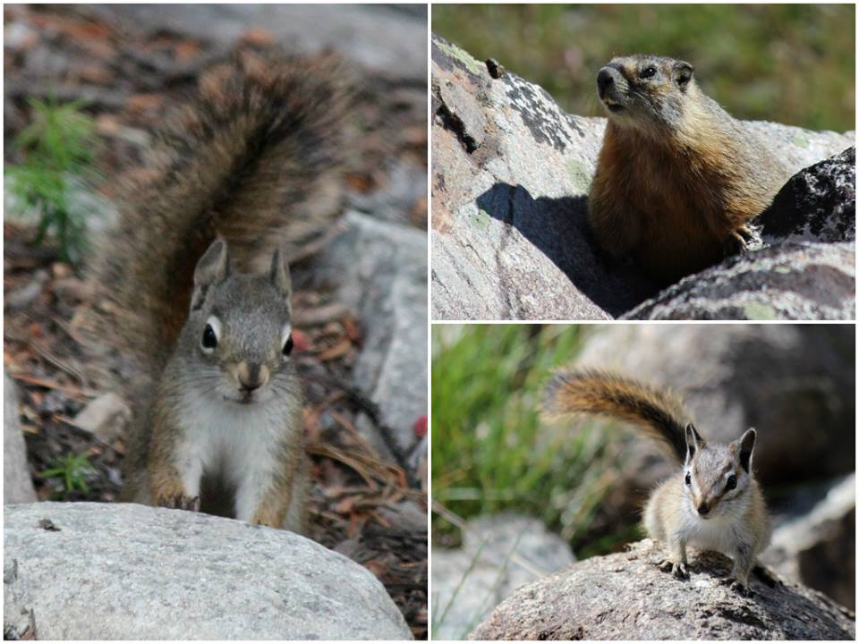
We had bluebird skies for the next two days, which was good luck because we had to cover some miles. We paddled about 30 miles on Day 2. It's been a really low water year and the current was noticeably slow. But as long as we steadily paddled we could cover around 4.5 miles/hour. We stopped at the River Register around mile XX to check out the creepy ghost-face inscription. Frankie was a good sport, too. She squirmed around a little bit, but eventually found her spot in the middle of the boat. As long as we let her out every once and a while to swim and catch sticks she did just fine.

Camping on the second night was a little rough. First of all, we had a tough time finding a campsite as we approached the Bowknot. The banks were choked with tamarisks and willows, so there weren't many sandy beaches conducive to camping. The same thing actually happened when I did this trip in 2010, but I assumed that was because it was such a high water year. Nope -- it was tricky both times. We ended up finding a mosquito-infested patch of dry dirt, but it was pretty miserable. My advise -- if you're approaching the Bowknot, stop early and grab whatever patch of real-estate you can find!
On the last day, we took our time to paddle the final 18 miles. The weather was great, and we stopped to see the Denis Julien inscription in Hell Roaring Canyon. Hell Roaring Canyon is near river mile XX, and the inscription is about 200 yards up the canyon on the right side. Denis Julien was a French-Canadian fur trapper in the 19th century who was the first documented white guy to navigate Cataract Canyon and the lower reached of the Green. Neat. Late that afternoon, we met up with our shuttle guy, Bob, who loaded up the canoe and drove us back to civilization. Great trip.

If you want to paddle through Labyrnith Canyon, there's some logistical BS to work through (but that's normal for a river trip, eh?) The permit process is actually easier than most overnight river trips in the area, so it's totally worth it. You'll need to fill out a permit ahead of time, but it's free and easy to get. Print off the form on the BLM's website, take both copies to the put-in, leave one copy at the put-in, and take the other copy down the river with you. After that, you'll have to figure out the shuttle. We put in at Green River State Park and took out at Mineral Bottom. We rented a canoe and arranged a shuttle through Moki Mac River Expeditions. They were a little pricey, but Bob was great to work with. If you have time, it's definitely cheaper to do your own shuttle (check out the map below,) and it takes about 3 hours to get from Green River to Mineral Bottom and back. Mineral Bottom is a decent dirt road, but it's steeeeep and can be impassable if wet. It's also a great idea to bring Belknap's Canyonlands River Guide along -- the waterproof pages are filled with maps containing notations and topographic contour lines. It also shows the locations of the major features of the river, rapids, archaeological sites, etc. It's easy to get disoriented when the river keeps taking hairpin turns -- the river guide keeps you situated!
The timing was perfect, too. We're at that seasonal sweet spot between summer and fall -- temperatures are hovering in the high-70s during the day and dropping to a cozy 50 at night. The timing was also right for our 17-week old puppy, Frankie. She's still small enough to fit in the middle of a canoe amid all our overnight gear, which probably won't be the case much longer! She's also too small to go on big hiking trips, so this was a great way to take her a big multi-night adventure.


The flatwater trip through Labyrinth Canyon starts in Green River, UT and winds 68-miles to Mineral Bottom. It's a seriously gorgeous trip. The river snakes through soaring red cliffs, passes bizarre rock art, and scoots around precipitous bowknot bends. We only had 3 days to do the trip, but it would have been nice to take 4. Half the fun of river trips is getting out of the boat to hike around, but we had to plow to cover the miles.
Our first day didn't start off too promising. We started at Green River State Park during a heavy-duty storm -- thunder was crashing and rain was pouring. But we pushed on and hid out under willow thickets when lightening got to close. Honestly, the scenery isn't all that impressive on the first day, so it wasn't a big deal to cinch up our raincoats and plow. We paddled about 20 miles before calling it a day and setting up camp on a sand bar near Ruby Ranch.
We had bluebird skies for the next two days, which was good luck because we had to cover some miles. We paddled about 30 miles on Day 2. It's been a really low water year and the current was noticeably slow. But as long as we steadily paddled we could cover around 4.5 miles/hour. We stopped at the River Register around mile XX to check out the creepy ghost-face inscription. Frankie was a good sport, too. She squirmed around a little bit, but eventually found her spot in the middle of the boat. As long as we let her out every once and a while to swim and catch sticks she did just fine.
 |
| River Register |

 |
| Frankenstein the River Monster |
Camping on the second night was a little rough. First of all, we had a tough time finding a campsite as we approached the Bowknot. The banks were choked with tamarisks and willows, so there weren't many sandy beaches conducive to camping. The same thing actually happened when I did this trip in 2010, but I assumed that was because it was such a high water year. Nope -- it was tricky both times. We ended up finding a mosquito-infested patch of dry dirt, but it was pretty miserable. My advise -- if you're approaching the Bowknot, stop early and grab whatever patch of real-estate you can find!
On the last day, we took our time to paddle the final 18 miles. The weather was great, and we stopped to see the Denis Julien inscription in Hell Roaring Canyon. Hell Roaring Canyon is near river mile XX, and the inscription is about 200 yards up the canyon on the right side. Denis Julien was a French-Canadian fur trapper in the 19th century who was the first documented white guy to navigate Cataract Canyon and the lower reached of the Green. Neat. Late that afternoon, we met up with our shuttle guy, Bob, who loaded up the canoe and drove us back to civilization. Great trip.
 |
| D. Julien inscription |

If you want to paddle through Labyrnith Canyon, there's some logistical BS to work through (but that's normal for a river trip, eh?) The permit process is actually easier than most overnight river trips in the area, so it's totally worth it. You'll need to fill out a permit ahead of time, but it's free and easy to get. Print off the form on the BLM's website, take both copies to the put-in, leave one copy at the put-in, and take the other copy down the river with you. After that, you'll have to figure out the shuttle. We put in at Green River State Park and took out at Mineral Bottom. We rented a canoe and arranged a shuttle through Moki Mac River Expeditions. They were a little pricey, but Bob was great to work with. If you have time, it's definitely cheaper to do your own shuttle (check out the map below,) and it takes about 3 hours to get from Green River to Mineral Bottom and back. Mineral Bottom is a decent dirt road, but it's steeeeep and can be impassable if wet. It's also a great idea to bring Belknap's Canyonlands River Guide along -- the waterproof pages are filled with maps containing notations and topographic contour lines. It also shows the locations of the major features of the river, rapids, archaeological sites, etc. It's easy to get disoriented when the river keeps taking hairpin turns -- the river guide keeps you situated!
 |
| map credit: blm.gov |
Tuesday, September 10, 2013
The Pine Creek Box
It's definitely a time of transition. Southern Utah is tottering right on the edge of summer and fall -- temperatures are still in the 80s, but the blistering edge is starting to wear down. To escape the heat, we've spent all our summer weekends up in the mountains, which is wonderful, but after a while I start to crave red rock again.

The Pine Creek Box in Dixie National Forest was a perfect compromise for this late-summer weekend. The hike follows a creek through a scenic canyon on the southern foothills of the Aquarius Plateau. It perfectly bridges the gap between mountain and desert -- you're surrounded by 1,000 ft rock cliffs and ponderosa pine. It was also a great hike for our 16-week old puppy, Frankie. Frankie is a trooper and a great adventure buddy, but she only has enough energy for about 3 hours of hiking before she gets tuckered out. Consequently, we weren't able to hike the entire 8.8-mile trail, but it was still worthwhile to explore out-and-back from the lower trailhead. We'd definitely like to come back when the dog is a little older to do the whole thing.


To hike the entire Pine Creek Box, you'll need a shuttle vehicle or a bike. To get to the trailheads, drive north from the town of Escalante towards Boulder on the Hells Backbone Road. It's a good gravel road that's okay for passenger cars. After 8 miles, you'll see a sign for the "Lower Box Access." You can only drive a short distant before the road washes out, but it's a easy walk the rest of the way. Leave a car here. Continue driving north on the Hells Backbone Road 10.8 miles until you see a sign that says "Upper Box Access." Start your hike here.
There isn't really a formal trail, but it's easy to just follow the creek downstream. You'll be crossing the creek regularly, so don't try too hard to keep your feet dry. The path is easy, there isn't any rock-scrambling involved, and the creek rarely gets more than shin-deep. Basically, this is an mellow, refreshing hike that's great for puppies. :)


Tuesday, August 20, 2013
Frankie's first camping trip
Whoa. Usually I'm pretty gung-ho with weekend planning and know exactly what I want to do. But I had to shift gears this time around ... what can you do with a new puppy? We really want Frankie to be the ultimate adventure buddy, but we weren't sure how far she could hike (she's only 10 weeks old!), we didn't want to fry her in the desert heat, and there are lots of places where dog aren't allowed (National Parks, etc.) So what do to?
Eventually we decided to head up to Grand Mesa, just outside Grand Junction, Colorado. Grand Mesa is one of the biggest flat-top mountains in the world. Its elevation gets up to 11,333 feet, so everything was coated in pine trees and dotted with alpine lakes. We figured Frankie wouldn't get too hot and she'd have places to swim. Grand Mesa is managed by the US Forest Service, so dogs are allowed.


We ran a couple errands in Grand Junction, then drove up the Mesa. It was beautiful up there -- aspen, pines, mushrooms, moss, and alpine lakes. We stopped at the Island Lake campground (10,000',) along SR-65 about 33 miles from I-70. Usually we steer clear of big established campgrounds, but it was getting late. We actually found a perfect spot tucked amid a bunch of spruce trees and away from the big RVs. Frankie was laaaaaaving it -- it was so funny to watch her explore. She's lived in the desert her entire life, so a cool pine forest was totally foreign to her. After lots of sniffing and running around, she zonked out. She loved the tent, too, which seems like an auspicious start for an adventure buddy.


The next day, we rented a canoe at the nearby Grand Mesa Lodge and tried out our new fishing pole. Jordan and I have tried fly fishing a couple times before but never really got the hang of it, so we bought a plain ol' rod and reel. And it totally worked! We canoed around the lake, Frankie slept in the middle, and we each caught a trout. A nasty hail storm sent us scurrying back to shore, but all and all it was a great trip!


Thursday, August 15, 2013
Frankie!
Ladies and gentlemen -- Frankie! Oh lord, she's cute.
This definitely wasn't a planned thing. One of our coworkers just bred his Chesapeake Bay Retriever, and he brought one of the last puppies of the litter over to our house a couple nights ago. At first we laughed him off ('We already have two cats! Dogs are so much work! What happens when we go on vacation / want to move / etc.?') But then we started playing with her. She spent the night on a 'trial run,' which of course sealed the deal. And now we have a dog!
This definitely wasn't a planned thing. One of our coworkers just bred his Chesapeake Bay Retriever, and he brought one of the last puppies of the litter over to our house a couple nights ago. At first we laughed him off ('We already have two cats! Dogs are so much work! What happens when we go on vacation / want to move / etc.?') But then we started playing with her. She spent the night on a 'trial run,' which of course sealed the deal. And now we have a dog!

I guess we always put off getting a dog because I assumed they'd cramp our style. They're definitely more high-maintenance than cats and you have to keep them in mind when you make plans. But Frankie has been an easy puppy so far, and I think she's going to be the ultimate adventure buddy. Chessies are known for being super-smart, alert, and tough. They were bred to hunt ducks, so she's comfortable in the water -- she's only 10 weeks old and we've already taken her swimming and hiking! Frankie is going to be a big, tough dog when she's full grown and I'm sure she can come on most of our escapades. Our first big adventure -- house training!

Tuesday, August 6, 2013
Wind River Backpack
HONEYMOON! Oh man, I needed this. The wedding reception was fantastic, but it's definitely time to step back from all the girly details and lace up my boots. And the big promotion has been really rewarding and challenging, but sometimes I just need to zone out and walk. Our 4-day backpacking trip through the cool granite peaks of Wyoming's Wind River Range totally fit the bill.

The Wind River Range rises abruptly from the sagebrush hills of west-central Wyoming, forming towering granite peaks along the Continental Divide. It's dotted with amazing alpine lakes, clear trout streams, year-round glaciers, and dense conifer forests. Almost a million acres of the Winds are protected as designated wilderness. The place is swarming with heavy-duty critters like elk, bighorn sheep, moose, marmots, black bears, and grizzlies. Jordan and I were a little nervous about camping in grizzly country, but the only blood we lost was to the swarms of blood-sucking mosquitoes!


I've been wanting to hike the Winds for years, and it seemed especially appropriate now that we live in Green River. The Winds are actually the headwaters of the Green, and I really liked the geeky continuity. It was great to image these blue lakes and clear creeks flowing 610 miles south to become the silt-laden, canyon carving behemoth that runs by our house.
There are over 700 miles of trail in the Wind River Range, and we had a tough time decided where to go. These mountains are really popular with backpackers, and because the hiking season is so short, we were worried we'd be dealing with crowds and tent cities. Still, we decided to bite the bullet and head towards Titcomb Basin -- one of the most beautiful (and popular) spots in the Winds. In the end, the crowds were seriously overstated, and the view was totally worth it ...


The drive from Green River, UT to Pinedale, WY took about 7.5 hours. We costed into Pinedale late at night, crashed at a hotel, and made our way to the Elkhart Park trailhead the next morning. The trailhead is located about 14.5 miles from town along a paved road, and just driving there gets you to 9,359'. That means you don't have to climb very far to get above treeline and start seeing those jaw-dropping granite peaks.
Day 1:
We planned to hike a total of 31.8 miles on this trip to explore Titcomb Basin and the surrounding area. We wanted to take our time, investigate, and take loads of pictures, so we decided to stretch it out over 4 days. On our first day, we hiked 9 miles along the Pole Creek Trail from the Elkhart Park Trailhead to Seneca Lake. This was the toughest stretch of trail because we had to climb about 2,000 feet without the payoff of any epic views -- we were socked in by lodgepole pines for the first couple hours. Gradually, however, the dense forest started to open up and we saw our first pretty meadow and rushing creek. As we approached treeline, the scenery got better and better. Photographer's Point was amazing -- we had an epic view of the bold, serrated northern peaks that brought us to this place. But by far the biggest payoff was Seneca Lake itself, where we camped for the night. We found a little ledge just big enough for our tent, and watched the sun set over the deep blue lake.


Day 2:
The next morning, we packed up our stuff and started the hike from Seneca Lake to Titcomb Basin. We skirted a half dozen gorgeous alpine lakes -- each one was more incredible than the last. Great gray domes of granite were reflected in clear blue water, fringed by scattered whitebark pine growing in gnarled, krummholz shapes. We were hiking during the alpine tundra's short growing seasons, and the ground was coated with wildflowers -- buttercup, lupine, alpine bistort, mountain bluebells, mountain heather and Indian paintbrush. We made terrible time because we kept stopping to gawk. Still, when we hit Titcomb Basin we almost had the place to ourselves.


Day 3 & 4:
Over the course of the next two days, we turned around and re-traced our route back to Elkhart Park trailhead. Sure, out-and-back hikes aren't usually as entertaining as loop hikes or through-hikes, but this trail was so beautiful that I didn't really mind. On the third night, we camped at a different spot along the edge of Hobbs Lake. Near the end of the hike, we saw a pissed-off mamma moose with twin calves. She wasn't happy at all and actually took a couple angry steps towards us before we scooted off!


"The Wind River Mountains are supposed by the Indians to be the home of the spirits, and they believe a person can see the spirit land, or the land they will occupy after death, from the top of them. They are fond of describing the beauties of this land, and the enjoyments and pleasures they will find therein: fresh and pure streams; wide prairies covered with grass and flowers, and abounding in deer, beautiful squaws to wait upon them; horses, always ready and never tired, to take part in the chase; new lodges supplied with every comfort, and provisions and meat so plentiful that they will never again suffer the pangs of hunger.

 |
| Bruce helps with honeymoon planning. |
The Wind River Range rises abruptly from the sagebrush hills of west-central Wyoming, forming towering granite peaks along the Continental Divide. It's dotted with amazing alpine lakes, clear trout streams, year-round glaciers, and dense conifer forests. Almost a million acres of the Winds are protected as designated wilderness. The place is swarming with heavy-duty critters like elk, bighorn sheep, moose, marmots, black bears, and grizzlies. Jordan and I were a little nervous about camping in grizzly country, but the only blood we lost was to the swarms of blood-sucking mosquitoes!


I've been wanting to hike the Winds for years, and it seemed especially appropriate now that we live in Green River. The Winds are actually the headwaters of the Green, and I really liked the geeky continuity. It was great to image these blue lakes and clear creeks flowing 610 miles south to become the silt-laden, canyon carving behemoth that runs by our house.
There are over 700 miles of trail in the Wind River Range, and we had a tough time decided where to go. These mountains are really popular with backpackers, and because the hiking season is so short, we were worried we'd be dealing with crowds and tent cities. Still, we decided to bite the bullet and head towards Titcomb Basin -- one of the most beautiful (and popular) spots in the Winds. In the end, the crowds were seriously overstated, and the view was totally worth it ...


 |
| road from Pinedale to Elkhart Lake Trailhead |
Day 1:
We planned to hike a total of 31.8 miles on this trip to explore Titcomb Basin and the surrounding area. We wanted to take our time, investigate, and take loads of pictures, so we decided to stretch it out over 4 days. On our first day, we hiked 9 miles along the Pole Creek Trail from the Elkhart Park Trailhead to Seneca Lake. This was the toughest stretch of trail because we had to climb about 2,000 feet without the payoff of any epic views -- we were socked in by lodgepole pines for the first couple hours. Gradually, however, the dense forest started to open up and we saw our first pretty meadow and rushing creek. As we approached treeline, the scenery got better and better. Photographer's Point was amazing -- we had an epic view of the bold, serrated northern peaks that brought us to this place. But by far the biggest payoff was Seneca Lake itself, where we camped for the night. We found a little ledge just big enough for our tent, and watched the sun set over the deep blue lake.

 |
| turbo fashion! |

Day 2:
The next morning, we packed up our stuff and started the hike from Seneca Lake to Titcomb Basin. We skirted a half dozen gorgeous alpine lakes -- each one was more incredible than the last. Great gray domes of granite were reflected in clear blue water, fringed by scattered whitebark pine growing in gnarled, krummholz shapes. We were hiking during the alpine tundra's short growing seasons, and the ground was coated with wildflowers -- buttercup, lupine, alpine bistort, mountain bluebells, mountain heather and Indian paintbrush. We made terrible time because we kept stopping to gawk. Still, when we hit Titcomb Basin we almost had the place to ourselves.


Day 3 & 4:
Over the course of the next two days, we turned around and re-traced our route back to Elkhart Park trailhead. Sure, out-and-back hikes aren't usually as entertaining as loop hikes or through-hikes, but this trail was so beautiful that I didn't really mind. On the third night, we camped at a different spot along the edge of Hobbs Lake. Near the end of the hike, we saw a pissed-off mamma moose with twin calves. She wasn't happy at all and actually took a couple angry steps towards us before we scooted off!


We shuffled back to the trailhead on the afternoon of the fourth day, tired but satisfied. This was such a fantastic hike. It was a perfect break from the desert summer, girly wedding planning, and the big new job. I totally understand why people take honeymoons. Sure, it's an excuse for a big snazzy vacation, but it's also a time to pause, take a second to process big life changes, and prep yourself for what's to come.


They believe that when a good Indian dies, he falls into a beautiful stream of bright, fresh water, and is carried to the pleasant grounds I have described. When an old man is dying he finds himself near the top of a high hill on the Wind River Mountains, and as the breath leaves his body, he reaches the top of it, and there, in front of him, the whole magnificent landscape of eternity is spread out, and the Sun-Father is there to receive him and to do everything in his power to make him happy."
- Col. Albert G. Brackett, The Shoshonis, or Snake Indians, Their Religion, Superstitions, and Manners, Annual Report, Smithsonian Institude, 1879.
Subscribe to:
Posts (Atom)