HONEYMOON! Oh man, I needed this. The wedding reception was fantastic, but it's definitely time to step back from all the girly details and lace up my boots. And the big promotion has been really rewarding and challenging, but sometimes I just need to zone out and walk. Our 4-day backpacking trip through the cool granite peaks of Wyoming's Wind River Range totally fit the bill.

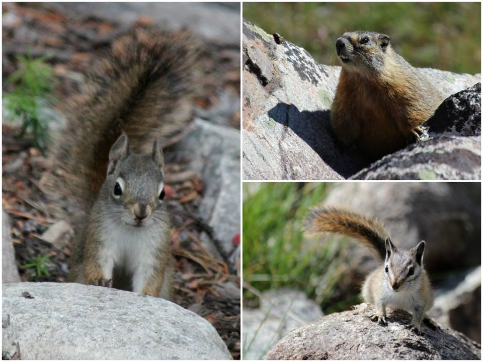
The Wind River Range rises abruptly from the sagebrush hills of west-central Wyoming, forming towering granite peaks along the Continental Divide. It's dotted with amazing alpine lakes, clear trout streams, year-round glaciers, and dense conifer forests. Almost a million acres of the Winds are protected as designated wilderness. The place is swarming with heavy-duty critters like elk, bighorn sheep, moose, marmots, black bears, and grizzlies. Jordan and I were a little nervous about camping in grizzly country, but the only blood we lost was to the swarms of blood-sucking mosquitoes!


I've been wanting to hike the Winds for years, and it seemed especially appropriate now that we live in Green River. The Winds are actually the headwaters of the Green, and I really liked the geeky continuity. It was great to image these blue lakes and clear creeks flowing 610 miles south to become the silt-laden, canyon carving behemoth that runs by our house.
There are over 700 miles of trail in the Wind River Range, and we had a tough time decided where to go. These mountains are really popular with backpackers, and because the hiking season is so short, we were worried we'd be dealing with crowds and tent cities. Still, we decided to bite the bullet and head towards Titcomb Basin -- one of the most beautiful (and popular) spots in the Winds. In the end, the crowds were seriously overstated, and the view was totally worth it ...


The drive from Green River, UT to Pinedale, WY took about 7.5 hours. We costed into Pinedale late at night, crashed at a hotel, and made our way to the Elkhart Park trailhead the next morning. The trailhead is located about 14.5 miles from town along a paved road, and just driving there gets you to 9,359'. That means you don't have to climb very far to get above treeline and start seeing those jaw-dropping granite peaks.
Day 1:
We planned to hike a total of 31.8 miles on this trip to explore Titcomb Basin and the surrounding area. We wanted to take our time, investigate, and take loads of pictures, so we decided to stretch it out over 4 days. On our first day, we hiked 9 miles along the Pole Creek Trail from the Elkhart Park Trailhead to Seneca Lake. This was the toughest stretch of trail because we had to climb about 2,000 feet without the payoff of any epic views -- we were socked in by lodgepole pines for the first couple hours. Gradually, however, the dense forest started to open up and we saw our first pretty meadow and rushing creek. As we approached treeline, the scenery got better and better. Photographer's Point was amazing -- we had an epic view of the bold, serrated northern peaks that brought us to this place. But by far the biggest payoff was Seneca Lake itself, where we camped for the night. We found a little ledge just big enough for our tent, and watched the sun set over the deep blue lake.


Day 2:
The next morning, we packed up our stuff and started the hike from Seneca Lake to Titcomb Basin. We skirted a half dozen gorgeous alpine lakes -- each one was more incredible than the last. Great gray domes of granite were reflected in clear blue water, fringed by scattered whitebark pine growing in gnarled, krummholz shapes. We were hiking during the alpine tundra's short growing seasons, and the ground was coated with wildflowers -- buttercup, lupine, alpine bistort, mountain bluebells, mountain heather and Indian paintbrush. We made terrible time because we kept stopping to gawk. Still, when we hit Titcomb Basin we almost had the place to ourselves.


Day 3 & 4:
Over the course of the next two days, we turned around and re-traced our route back to Elkhart Park trailhead. Sure, out-and-back hikes aren't usually as entertaining as loop hikes or through-hikes, but this trail was so beautiful that I didn't really mind. On the third night, we camped at a different spot along the edge of Hobbs Lake. Near the end of the hike, we saw a pissed-off mamma moose with twin calves. She wasn't happy at all and actually took a couple angry steps towards us before we scooted off!


"The Wind River Mountains are supposed by the Indians to be the home of the spirits, and they believe a person can see the spirit land, or the land they will occupy after death, from the top of them. They are fond of describing the beauties of this land, and the enjoyments and pleasures they will find therein: fresh and pure streams; wide prairies covered with grass and flowers, and abounding in deer, beautiful squaws to wait upon them; horses, always ready and never tired, to take part in the chase; new lodges supplied with every comfort, and provisions and meat so plentiful that they will never again suffer the pangs of hunger.

 |
| Bruce helps with honeymoon planning. |
The Wind River Range rises abruptly from the sagebrush hills of west-central Wyoming, forming towering granite peaks along the Continental Divide. It's dotted with amazing alpine lakes, clear trout streams, year-round glaciers, and dense conifer forests. Almost a million acres of the Winds are protected as designated wilderness. The place is swarming with heavy-duty critters like elk, bighorn sheep, moose, marmots, black bears, and grizzlies. Jordan and I were a little nervous about camping in grizzly country, but the only blood we lost was to the swarms of blood-sucking mosquitoes!


I've been wanting to hike the Winds for years, and it seemed especially appropriate now that we live in Green River. The Winds are actually the headwaters of the Green, and I really liked the geeky continuity. It was great to image these blue lakes and clear creeks flowing 610 miles south to become the silt-laden, canyon carving behemoth that runs by our house.
There are over 700 miles of trail in the Wind River Range, and we had a tough time decided where to go. These mountains are really popular with backpackers, and because the hiking season is so short, we were worried we'd be dealing with crowds and tent cities. Still, we decided to bite the bullet and head towards Titcomb Basin -- one of the most beautiful (and popular) spots in the Winds. In the end, the crowds were seriously overstated, and the view was totally worth it ...


 |
| road from Pinedale to Elkhart Lake Trailhead |
Day 1:
We planned to hike a total of 31.8 miles on this trip to explore Titcomb Basin and the surrounding area. We wanted to take our time, investigate, and take loads of pictures, so we decided to stretch it out over 4 days. On our first day, we hiked 9 miles along the Pole Creek Trail from the Elkhart Park Trailhead to Seneca Lake. This was the toughest stretch of trail because we had to climb about 2,000 feet without the payoff of any epic views -- we were socked in by lodgepole pines for the first couple hours. Gradually, however, the dense forest started to open up and we saw our first pretty meadow and rushing creek. As we approached treeline, the scenery got better and better. Photographer's Point was amazing -- we had an epic view of the bold, serrated northern peaks that brought us to this place. But by far the biggest payoff was Seneca Lake itself, where we camped for the night. We found a little ledge just big enough for our tent, and watched the sun set over the deep blue lake.

 |
| turbo fashion! |

Day 2:
The next morning, we packed up our stuff and started the hike from Seneca Lake to Titcomb Basin. We skirted a half dozen gorgeous alpine lakes -- each one was more incredible than the last. Great gray domes of granite were reflected in clear blue water, fringed by scattered whitebark pine growing in gnarled, krummholz shapes. We were hiking during the alpine tundra's short growing seasons, and the ground was coated with wildflowers -- buttercup, lupine, alpine bistort, mountain bluebells, mountain heather and Indian paintbrush. We made terrible time because we kept stopping to gawk. Still, when we hit Titcomb Basin we almost had the place to ourselves.


Day 3 & 4:
Over the course of the next two days, we turned around and re-traced our route back to Elkhart Park trailhead. Sure, out-and-back hikes aren't usually as entertaining as loop hikes or through-hikes, but this trail was so beautiful that I didn't really mind. On the third night, we camped at a different spot along the edge of Hobbs Lake. Near the end of the hike, we saw a pissed-off mamma moose with twin calves. She wasn't happy at all and actually took a couple angry steps towards us before we scooted off!


We shuffled back to the trailhead on the afternoon of the fourth day, tired but satisfied. This was such a fantastic hike. It was a perfect break from the desert summer, girly wedding planning, and the big new job. I totally understand why people take honeymoons. Sure, it's an excuse for a big snazzy vacation, but it's also a time to pause, take a second to process big life changes, and prep yourself for what's to come.


They believe that when a good Indian dies, he falls into a beautiful stream of bright, fresh water, and is carried to the pleasant grounds I have described. When an old man is dying he finds himself near the top of a high hill on the Wind River Mountains, and as the breath leaves his body, he reaches the top of it, and there, in front of him, the whole magnificent landscape of eternity is spread out, and the Sun-Father is there to receive him and to do everything in his power to make him happy."
- Col. Albert G. Brackett, The Shoshonis, or Snake Indians, Their Religion, Superstitions, and Manners, Annual Report, Smithsonian Institude, 1879.


