Sunday, January 6, 2013

Three Finger Canyon

The freeeeezing cold continues (low of negative 15!,) so it was pretty tough to convince ourselves to leave the house this morning.  We sucked it up in the afternoon for a quick trip to Three Finger Canyon.  Three Finger is located along the eastern edge of the San Rafael Reef, and it’s full of bizarre diagonal rock layers and loads of petroglyphs.

The approach is as cool as the canyon itself -- the San Rafael Reef is a wall of diagonal flatiron-shaped rocks in a cacophony of color and texture.  I see it every day on my drive to work, but it's always fun to get up close and explore the nooks and crannies.

San Rafael Reef just outside Three Finger Canyon 


The petroglyphs are just inside the canyon, to your right, on blackened Navajo sandstone.  Some of the rock art is actually on the slope leading up to the overhang, so make sure you watch where you step!  Look for a small, deep alcove and some cool tafoni (that rock that erodes like swiss-cheese.)

petroglyphs
three fingers!
tafoni erosion in the sandstone 

We hiked further back into the canyon and found a bunch of crazy rocks.  There was a sketchy old mine digging into a vein of what looked like malachite and petrified wood.  Really pretty.

petrified wood with iron?

The road to Three Finger Canyon is passable for most high-clearance 2WD vehicles, but it's sort of funky to find.  Drive west along I-70 past the Hanksville exit and the San Rafael River.  Right after the river you pull off the side of interstate onto a little dirt road.  It's weird -- there's no exit or turning lane.  Drive through the underpass, and start driving south as you skirt the eastern edge of the San Rafael Reef.

Wednesday, January 2, 2013

New Year's in Moab

Happy New Year!  Sweetbabyjebus, 2012 was a big one.  I always get cheesy and retrospective at the end of the year, especially since December 31 is my birthday.  So as I turned 29 and 2012 drew to a close, I scanned over this blog to relive some of my favorite adventures.  This has to be one of my best years out in Utah -- we did so much stuff!  Jordan and I got engaged and I bought a mountain bike.  We floated the San Juan River, explored the Black Hills, delved into the Black Canyon of the Gunnsion, backpacked Grand Gulch, ran a half marathon, rappelled the Goblin's Lair with my sister, etc., etc., etc.  Holy shit, I'm lucky.  Looking back on everything makes me realize how fortunate I am to live in such a cool place and be able to spend so much time exploring it.  Hells yeah!

Anyway, this New Year's Eve was the perfect end to a great year.  Shasta, my best friend from back home, finally came out to visit!  We had a blast.  I got to show her Goblin Valley, Dead Horse Point, Arches, and Canyonlands.  We ran around and took a bunch of pictures.  It's always fun to experience Utah through the eyes of someone who's never been here before and see things with a fresh perspective.

We hailed in the New Year with a bunch of friends at the infamous Woody's Tavern.  Huge success!
Dead Horse Point
Dead Horse Point

Canyonlands
New Year's Eve at Woody's
New Year's day @ Arches


Crystal Geyser

On the second day of Shasta's visit, we took a quick trip to check out Crystal Geyser.  Crystal Geyser is a rare example of a cold water geyser located along the banks of the Green River.  The geyser was created by an exploration well drilled in 1935 in an attempt to locate oil.  The ground water near the geyser has loads of dissolved carbon dioxide, which can create enough pressure to force groundwater to the surface in big eruptions up to 40 meters high!


Unfortunately, we didn't get to see the eruption.  Crystal Geyser is pretty unpredictable -- it can go off anywhere between every hour to 24+ hours!  Even though we weren't lucky enough to see an eruption, it was still a cool place to visit.  The area surrounding the geyser is covered in thick layers of an orange travertine mineral brought up by years of eruptions.

To get to the Crystal Geyser, take the east Green River exit (exit 164). Go south, then east (left) onto the frontage road that parallels the highway. After 2.2 miles, turn south (right) and continue 3.5 more miles to a junction. Go right, and travel about 0.5 miles to the geyser.

You can also access the geyser at the very beginning of a 3-day flatwater trip through Labyrinth Canyon like we did back in 2010.

Labyrinth Canyon kayak trip in 2012


Wednesday, December 26, 2012

Christmas in the San Juan Mountains

One of the downsides of working at Goblin Valley is that we have to work holidays.  The other ranger and I are pretty good about swapping holiday duty -- I went home for Thanksgiving this year, so he gets Christmas.  It's definitely a bummer not seeing family during the holidays, but Jordan and I managed to sneak away for a couple days for a great consolation prize -- visiting Diana and Jerry in the San Juan Mountains near Ridgway, CO!


12" of new snow = guaranteed white Christmas

I love Christmas in the San Juans.  The mountains are coated in snow and the tiny towns are decked out with lights.  It's definitely a cheeseball-classic winter wonderland.  Jerry and Diana have a house up in Elk Meadows with a killer view of the Sneffels Range and loads of snow for us to play around in.  We didn't wander very far from their place all weekend, but we still managed to squeeze in loads of snowy shenanigans -- sledding, snowshoeing, riding ATVs, and building an igloo. Diana and Jerry are a blast and it was great to spend the holidays with such great friends.


redneck-style sledding!

Jordan and I have been talking about snow camping this winter, so we decided to test our igloo-building skills.  Fueled by copious brandy mixed with hot chocolate, we piled up a huge mound of snow and misted it periodically with a hose.  We let it set for a couple hours, then came back to hollow it out.  It took the better part of an afternoon to finish, but it was surprisingly cozy inside and totally bombproof.  Seriously, spraying it with water made it an ice bunker -- I bet it'll be there until next spring!


On Christmas Eve day, we rode the ATVs up to Top of the Pines to snowshoe.  The Top of the Pines building is still under construction, but eventually it's going to be an outdoor education/recreation/event center.  There were also 8 kilometers of groomed cross country ski and snowshoe trails, which we tooled around on for a couple hours.  Really pretty.


After hoofing around in the snow all day, we drove a couple miles down the road to Orvis Hot Springs for a soak.  Orvis is a natural hot springs resort near Ouray, CO with water that ranges from 98-112 degrees.  It also naturally contains lithium, which makes you feel super relaxed and loopy.  They have a couple big pools, the "lobster pop," a sauna, and two massage yurts.  There's nothing better than soaking in steaming hot water surrounded by falling snow.

That evening, the big storm rolled in!  While a foot of snow fell, we drank wine, belted out Christmas carols around a bonfire, unwrapped presents, and danced around all night.  Yay Christmas!
Diana at Top of the Pines


Tuesday, December 18, 2012

Skiing @ Powderhorn

Oh man, we finally went skiing!  How have I lived in Utah for almost 5 years and never gone downhill skiing?  No excuse.  We finally had decent snow this week, so we drove 40 miles east of Grand Junction, CO for the opening weekend of Powderhorn Mountain Resort!

So much fun!  Honestly, Jordan and I are both terrible skiers (the last time we both went was in high school, where a ski trip to *Iowa* was considered pretty awesome,) so we stuck to the beginner slopes, biffed a lot, and had a great time.  I really like the vibe at Powderhorn.  It's a nice mountain with good snow, but it's not really expensive or pretentious.  Even though we live near some world-class skiing (Park City! Telluride! Aspen!) it definitely doesn't make sense to blow a bunch of cash on those places until we get better.  Powderhorn was a great place to build up our non-existent skills.


We stayed a couple nights in the teeny-tiny town of Mesa, CO at the Wagonwheel Motel, which is only 4 miles from the slopes.  Mesa doesn't have much going on, but the motel was nice (in the elk-head-on-the-wall type way,) and we had some great food at Blink Twice.

On our second day out, we decided to snowshoe way up on the mesa.  We rode the West End lift up to the top, where Snow Patrol told us that no one had done the trail yet.  But the path was well-marked with blue blazes, so we decided to push on towards the Take Four lift anyway.  SWEETBABYJEBUS...  busting new trail through 3 feet of powder at 10,000 feet was one of the toughest things I've ever done (not gonna lie, Jordan led the way 99% of the time.)  But it was totally worth it -- it was gorgeous up there!  Lots of spruce, aspen, blue skies, and pure white snow.  It was totally quiet in that way only a snow-covered forest can be.  Perfect.


Map credit: www.powderhorn.com

Sunday, December 9, 2012

White Wash Sand Dunes

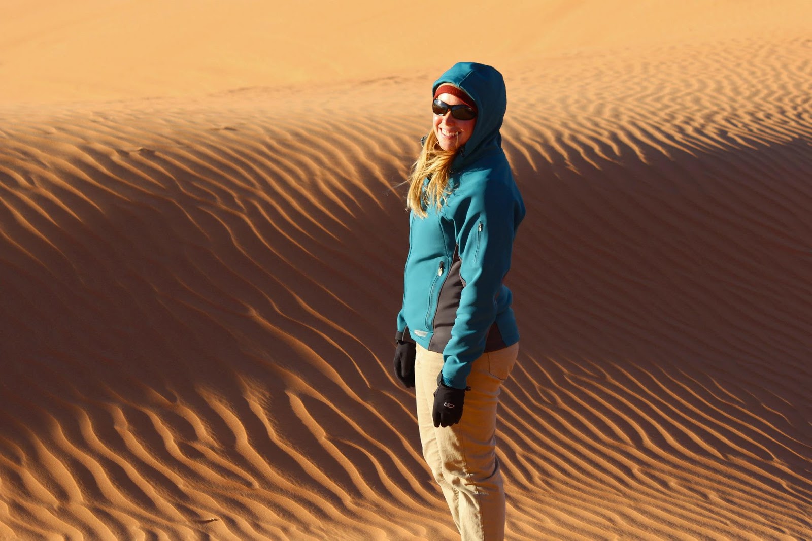
Brrr … winter is finally here!  It was windy and in the 40s, but we bundled up, hopped into the truck, and drove out to White Wash Sand Dunes Open OHV Area.  During the busy season, White Wash is swarming with ATVs and dirt bikes, but on this chilly December day, we had the place to ourselves.  The whole desert was really silent and surreal -- we hiked around orange sand dunes blown up against Entrada sandstone bluffs.  Sand dunes always remind me of scalding desert summers, so the contrast between its appearance and the icy wind was really cool.  Tenacious cottonwood trees branch out interspersed among the dunes, relying on underground pockets of water to grow.

On the drive in, we saw a studly bighorn sheep, who stared us down for a few minutes.  We found out later that the BLM installed a water guzzler for a small herd that lives east of dunes.  Sweet.


To get to Wish Wash Sand Dues, drive 13 miles east of Green River on Interstate 70 until you reach the "Floy" exit 175.  Drive south for about 12 miles, following the signs and making sure to bear rights after 4.5 miles.  Park at one of the large parking areas just west of the dunes.

Monday, December 3, 2012

La Sal Mt. Christmas Tree

It's officially December -- time to find a Christmas tree!  The temperatures are still hovering in the 50s down in the desert, so we drove up to the LaSal Moutains to have our first semi-snowy excursion of the winter.


50-degree red rock desert doesn't look like a promising start, but ...

During the week, we stopped by the US Forest Service office in Moab to grab a permit, which only costs $10.  They're open weekdays from 8:00am - 4:30pm.  For that price, you can cut down a tree up to 8 feet tall.  Pretty sweet deal.


On Sunday, we started the drive up into the mountains.  The LaSals aren't really that snowy yet, which was a little disconcerting.  It was 56 degrees down in the desert and there wasn't a speck of snow on the red rocks, so it was hard to feel super-Christmasy.  But as we started driving up the mountain, things got better.  We saw patches of snow and were surrounded by juniper, pinyon, and ponderosa.  There are a couple spots that the USFS recommends for Christmas trees, so we took the northernmost road that heads towards Gateway, CO.  The roads were still in pretty good shape-- we ran into a couple icy spots and had to toss rocks in the back of the 2WD Ranger, but it wasn't too much of a problem.  We passed the dinosaur tracks and pulled out on a tree-covered peninsular.  Jackpot!


We found what looked like a cute little pinyon and loaded it up in the back of the truck.  But here's a thing I learned about Christmas trees:  they look way smaller out in the woods than they do in a living room.  Our tree looks huge in our house, which was kind of awesome until it toppled over!  Jordan was a pro and decorated if for a second (and hopefully last!) time.

Decorated Tree II -- following the monstrous faceplant of Decorated Tree I.

About Us