Tuesday, April 30, 2013

Ruby + Horsethief Canyons River Trip

First river trip of the year!  The temperature cracked 80 for the first time this season, so we loaded up the ducky and hit the Colorado River.  We've done a lot of the Colorado River closer to Moab, so this time we decided to try the 25-mile section that goes through Ruby and Horsethief Canyons.  Most of the trip is flatwater with a couple riffles.  There's one set of Class II rapids around Black Rocks, and the river winds between tall orange cliffs and takes you past rock art, outcroppings of ancient black rocks, and spectacular spires.


Pack it up!

We recruited a GV seasonal, Taylor, and made plans for a really mellow, 2-day flatwater trip.  And the first day totally worked out that way -- we drank tons of beer, barely paddled, and called it a day at the Cottonwood campground.  We knew the next day would be a solid 20 miles, but figured if we got an early start it wouldn't be a problem.

Right ...


The next morning we hit the river and got a few miles in, but then ... the wind hit.  And it blew ALL DAY.  There were times when we paddled all-out and still went backwards!  It was rough.  It was a big 9-hour day -- my arms are definitely noodles right now.  Oh well.  It was still a really pretty trip, and if the weather had cooperated it would have been way more enjoyable.  Okay, enough griping -- here are the logistics:


American Avocets

If you want to do this trip, wait until the weather looks perfect!  The river starts off as calm flatwater.  You'll paddle through Horsethief Canyon, Rattlesnake Monocline, and Ruby Canyon.  Shortly after you exit Ruby Canyon, you'll hit the only rapids on the trip:  Black Rocks.  Black Rocks is easy to recognize because it's the only place where the river makes an abrupt left turn and black metamorphic rocks appear.   These black rocks are 1.7 billion years old -- about 220 million years older than the rocks that lie directly above them.  The gap in the geological record is a great example of a 'nonconformity.'  About 1/2 way through this mile-long section, several large boulders form the obvious rapid.  Just stay to the left and you'll miss most of it.  (Too bad the wind pushed us right into it ...)


Black Rocks


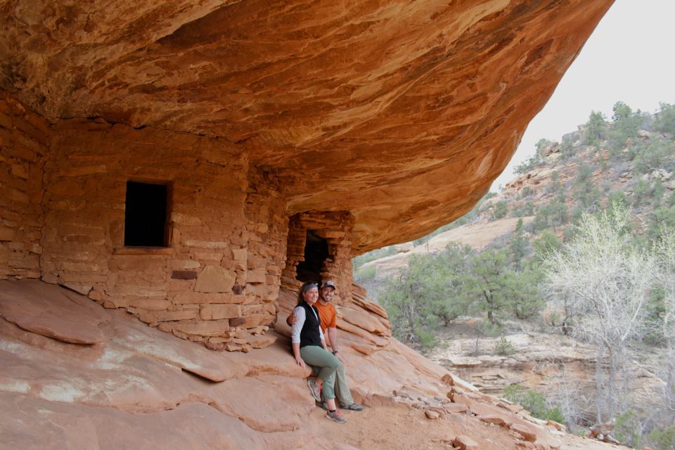
Just after Black Rocks, you'll see McDonald Canyon on the right side of the river.  If you hike up the canyon for about 10 minutes, you'll see a little Fremont rock art panel.  We didn't have a chance to check it out, but the canyon looked really nice.


If you're going to do the Ruby/Horsethief Canyon river trip, there are a couple logistical things to take care of first.  First of all, you need a car shuttle.  Put in at the Loma exit (Exit 15) just inside the Colorado border.  Go south off the highway and make a left at the T.  The boat ramp and parking is less than a mile from this junction.  Unload everything here.  Stash another car at the Westwater ramp.  To get to Westwater, travel back into Utah on I-70 for about 5 miles to the Westwater exit (Exit 227.) Travel south off the highway for about 9 miles to the ranger station, picnic area, and boat ramp.  The shuttle takes about 45 minutes each way.


You don't currently need a permit to float Ruby and Horsethief Canyons as a day trip.  However, if you want to split the trip into two days and camp in the canyon, check out the BLM's website for a camping permit.  As of right now, you need to make advanced reservations and pay a small fee if you're camping between May 1 and September 30.  We got in just before the start of the busy season, so there was no fee and we just filled out a camping permit at the Loma put-in.


Like most river trips, you're required to bring some gear.  Here's the BLM's official list of required and recommended gear.  Basically, river runners need to bring either a fire pan or a camp stove.  You need a Groover or WagBag, and you need to bring PDFs.  They recommend bringing a spare paddle, first aid kit, sunscreen, etc.

Thursday, April 25, 2013

Ferron Rock Art

This week, a couple of us from work busted out for a brainstorming / rock art finding roadtrip.  My bosses are the best -- instead of just sitting around an office making plans for the park, we drove around looking for rock art.  We always seem to come up with more creative ideas when we're exploring and hiking around.

This week, we drove out towards Ferron to find some Fremont and Barrier Canyon rock art panels.  Our Region Manager is a pro at finding obscure, remote rock art panels and he can remember places he hasn't visited for 20 years!  So the rest of us followed his lead to find the rock art in the Ferron Box and Short Canyon.  Honestly, we went on so many unmarked dirt roads that I have no idea how we found these panels.  But if you're in the Ferron area, it's definitely worth poking around!


Ferron Box
Molen Reef snake
Segregation Panel @ Ferron Box
   
Short Canyon
Short Canyon
Short Canyon


Luke's Trail

Price, UT is usually one of those places I visit for work and bureaucratic errands.  We're talking riveting activities like taking in water samples, getting a driver's license, and meeting with the BLM.  Fun stuff.  It's not a terrible town, it's just sort of utilitarian and unimaginative.

But if you dig a little deeper, there are really enjoyable places to visit.  (Isn't that always true?)  Price has a brewing company, a museum, and access to Nine Mile Canyon.  All good stuff.  This weekend, Jordan and I had to run a couple bureaucratic/utilitarian errands (e.g. getting a marriage license!,)  so we decided to try out some mountain bike trails in the area.


We drove just 0.5 mile north of town to the trailhead for Luke's Trails.  This area used to be totally trashed when locals would drive on top of the mesa and illegally dump their garbage.  A few years ago, a local mountain biker started cleaning up the mess and building unofficial guerrilla trails.  At first the BLM balked ("no environmental impact study?!") but they got on board once they saw how these volunteers had turned a trash heap into a great recreation area.

We started on Luke's Trail, which is a twisting singletrack on the mesa on the north edge of Price.  This intermediate-level trail winds through sage meadows and pinyon-juniper forests.  It also skirts the edge of the mesa for some great views of the Book Cliffs and the Roan Mountains.  The gray slopes sometimes look bleak, but when the sun hits them just right they have their own kind of subtle beauty.  We rode along Luke's Trail, took a short detour to Alan Alley, then looped back to the parking lot via the Cattleguard Cuttoff, S'mo Joes, and Knott Petes Rim.  The trail was fun, but it definitely has room for improvement.  Sometimes the trail surface was composed of big round rocks imbedded in soft tuft soil, so it was tough to keep a constant speed.  The trails also got closer to the cliff edge than it needed to be in some spots.  But for a volunteer-built trail so close to town, it was totally enjoyable.  I wouldn't plan my vacation around it, but it was a great way to polish off an errand-y weekend in Price.


The trailhead for Luke's Trail is just 1/2 mile from the north edge of town.  If you're eastbound on Highway 6, take the first Price exit.  Turn left (north) on 300 East. Drive to 900 North and turn left. The road will turn to dirt and/or narrow asphalt, and will veer right and climb the mesa.  0.5 mile later at the top of the mesa, fork left (west) and proceed 0.1 mile to the Lukes parking area.


map credit:  www.utahmountainbiking.com


Tuesday, April 16, 2013

Jones Hole Creek

The Jones Hole Creek trail is a wonderful 8-mile (round trip) hike located in the northwest corner of Dinosaur National Monument.  Vernal is an unapologetic mining town surrounded by flat gray desert, so a vivid green trout stream is a nice, unexpected surprise.  This 2,000-foot-deep gorge runs along the border between Utah and Colorado.  The trail starts just below the Jones Hole Fish Hatchery, and meanders pleasantly along the creek for about four miles to join the Green River.  The trail is fairly flat and easy to follow.

Jones Hole Creek
fish @ Jones Hole Fish Hatchery

This lush, green oasis is teaming with plants and wildlife.  Seriously, after living in the desert for five years, I'm pretty excited by clear water and critters!  I'm the world's worst fly fisher, but even I could tell this was a great trout stream. The water was crystal-clear, and you could see trout swimming and mayflies hatching.  A herd of five bighorn sheep let me watch them graze for a while.  I also saw deer, a pair of mergansers, and a rusty-colored marmot. 


About 1.7 miles south of the trailhead, you'll see a short spur trail that heads to the base of the western cliff.  This takes you to the Deluge Shelter rock art with a really vivid elk pictograph.  A little further south, there's a 0.5 mile side trail to the Ely Creek Falls.


Deluge Shelter pictograph

Finally, after 4 miles of hiking, I reached the Green River.  I wasn't sure what to expect, but it was really impressive.  The river was surrounded by soaring 2,000 foot cliffs and actually lived up to its name and looked green, instead of the sediment-laden brown I usually see back home.  I felt a weird sense of satisfaction knowing this same water would eventually flow by my home in Green River, UT -- a 4-hour drive and 226 river miles away.  I feel an epic whitewater trip brewing ...


The Green River -- 226 miles from home.
bighorn sheep


To get to the Jones Hole Creek trail, drive east out of Vernal on 500 North Street.  When the road forks, go left and follow the signs that say Jones Hole.  Follow the paved road for another 33 miles to the Jones Hole Fish Hatchery.  The trail starts at the south end of the hatchery, about two hundred yards from the visitor parking lot.

Fantasy Canyon

The sheer variety of landscapes around Vernal is pretty incredible.  Over the course of three days, I saw huge river canyons, crystal-clear trout streams, rainbow-colored desert mountains, and ... Fantasy Canyon.  This has got to be one of the most bizarre, spooky places in Utah.  It looks like a gray, filigreed Goblin Valley.


Even the drive there was bizarre.  Fantasy Canyon is about 37 miles south of Vernal, and I drove through an industrial desert landscape of oil rigs and natural gas pipelines.  The dirt was gray, the sky was gray, and the air smelled like a weird combination of natural gas, poo, and tuna.  I drove through the Uintah/Ouray Indian Reservation and saw a rotting horse carcass on the side of the road.  Lovely.  A constant stream of huge diesel trucks whizzed past me -- I'm sure there wasn't another Chevy Aveo for 100 miles.  It was all very weird and ominous, which definitely set the right tone.

I finally reached the parking area for Fantasy Canyon, which was totally unexpected.  The desert was gray and featureless for miles, then suddenly this gargoyle garden popped up.  The area was really small, but it was packed with layers of fragile rock formations.  Fantasy Canyon's rocks were deposited during the Eocene Epoch, 38 to 50 million years ago.  At that time, the Uinta Basin was covered by an enormous lake.  The sand and dirt at the lake bottom eventually compacted into rocks.  As the stones weathered at different rates, these weird rocks formations emerged from the landscape.  (Sound familiar?  It's pretty much exactly what happened at Goblin Valley.)  I spent an hour poking around, then drove back to civilization.


Dinosaur National Monument


After over four years in Utah and loads of epic weekends, I feel like I’ve at least done a cursory exploration of most of the major geographic regions in the state.  One of my favorite nerdy pleasures is unfolding a map and re-tracing roads and trails in my mind.  But there are still some big blank spots I haven't explored, including the area around Dinosaur National Monument.  Coincidentally, I had a work thing up in Vernal this week (the opening of the new Field House curational facility!) so I jumped at the chance to check out Dinosaur NM and the surrounding area.  Jordan had to go back to work, so this trip did double duty as my last solo weekend before we get married (one month -- holy sh*t!)

For as much as I knock National Park "windshield tours," that's always what I end up doing the first time I visit one.  I guess it's just a good way to get an overview of the place, knock out all the cheeseball sites, and scope out good places to dig a little deeper.  So the first thing I did at Dinosaur was visit the Quarry Exhibit Hall, which showcases a wall of 1,500 embedded dinosaur bones.  The entire back wall of the building is a quarry site full of fossils.  These bones are in such great condition -- many of the skeletons are nearly complete and arranged in the correct anatomical position.  Jordan and I get pretty excited finding tiny little bone shards when we're out hiking, so I can't imagine finding something like this!


camarasaurus skull

quarry wall

The Quarry Hall is what drew me to Dinosaur National Monument in the first place, but of course there's a lot more to see.  The landscape is a contorted rainbow of uplifted rock carved into steep canyons by the Green and Yampa Rivers.  Whitewater rafting is a big deal in Dinosaur NM, and I can see why.  From origins high in the Rocky Mountains, the Green and Yampa Rivers wind across sagebrush plains, then squeeze into tight canyons surrounding by soaring cliffs.  The wild Yampa is the last un-dammed river in the Colorado River system, and it has some crazy Class V rapids.  The Green is little more manageable with Class II-IV rapids.  Of course, it's tough to get your hands on a permit, but I'm definitely going to try!


Green River from the Split Mountain overlook
Green River from Jones Hole
Echo Park Overlook

Dinosaur NM is also full of incredible petroglyphs and pictographs.  I've seen a lot of rock art in Utah, but the classic Vernal style is really distinct.  
These images were created by the Fremont people around 800-1,200 years ago.  The figures tend to be trapezoid-shaped anthropomorphs with elaborate headdresses, necklaces, and earrings.  It's impossible to know exactly what rock art represents, but to me these figures seem a lot more war-like and foreboding.  Many of them are carrying shields and what look like decapitated human heads.  Spooky, but really cool.


McKee Spring Petroglyphs
lizard rock art along Cub Creek
map credit:  nps.gov

Friday, April 12, 2013

McConkie Ranch -- Dry Fork Canyon Archaeological Site

The rock art around Vernal is unbelievable.  I've seen a lot of rock art in Utah, but the classic Vernal style is really distinct.  These images were created by the Fremont people around 800-1,200 years ago.  The figures tend to be trapezoid-shaped anthropomorphs with elaborate headdresses, necklaces, and earrings.  It's impossible to know exactly what rock art represents, but to me these figures seem a lot more war-like and foreboding.  Many of them are carrying shields and decapitated human heads.  Spooky, but really cool.

check out those feet!

After work at the Field House, two coworkers and I went to explore the rock art at the McConkie Ranch.  There are dozens of intricate, well-preserved panels carved and painted onto the cliff walls.  The images are located on private property, but thankfully everything is open to the public.  A rough trail runs along the edge of the cliffs below the rock art, and the three of us spent an hour or so gawking and speculating.  It's definitely some of the most impressive, distinct rock art I've seen in Utah.

Three Kings panel

To reach the ranch, drive to downtown Vernal and then get onto 500 North Street. Follow that street west to 3500 West Street. Turn north and follow 3500 West to the McConkie Ranch Road. It is about 6.4 miles from the 500 N/3500 W intersection to the ranch road turnoff. As you follow 3500 West it becomes the Dry Fork Canyon Road.  A sign clearly marks the turnoff to McConkie Ranch. Follow the McConkie Ranch Road for about 1/2 mile to the signed parking area. All these roads are paved.

From the parking area, the Main Trail is clearly marked and leads immediately up the cliff to the rock art. The 3 Kings Trail also begins at the parking area. You have to hike through ranch fields to get to the rock art along the 3 Kings Trail, but it is well worth the effort. Follow the trail markers over a fence and through fields, and then up the cliff to the rock art. Keep going until a sign indicates you have reached the trail's end. From that point you will have a clear view of the 3 Kings Panel.


Thursday, April 11, 2013

Utah Field House of Natural History

Sweet!  This week, I actually got paid to go to a new place.  The Utah Field House of Natural History State Park Museum had its grand opening for the new curatorial facility, so a bunch of park employees (including Jordan and I) went to help out.  The Field House is a dinosaur extravaganza showcasing fossils found throughout the Uinta Basin.  The outside of the building is surrounded by life-size dinosaur replicas, including a Tyrannosaurus with six-inch teeth, a horned Triceratops, six-ton Stegosaurus, and a winged Pteranodon.  The inside of the museum reveals over 600 million years of life, from the Pennsylvanian to the Pleistocene.  You could definitely spend a solid days investigating all the artifacts.  My favorite exhibit is the wall of fossilized leaves -- each rock with the fossil imprint was shaped into a rectangle, then mounted on a green wall.  It's art.


grand opening!
fossilized leaf wall

However, very few museums can display all their artifacts, and the Field House is no exception.  The curatorial facility is a humidity- and temperature-controlled building where they keep fossils, bones and other artifacts they don't have room to show in the museum.  It won't typically be open to the public, but for the grand opening the community was invited to get a 'behind the scenes' look.  Each park employee had an artifact to talk about, so I pretended to be an expert on fossilized turtle shells for a day.  Sweet!


The Field House is located at 496 East Main Street, Vernal, UT 84078-2605.  To reach them, call (435) 789-3799.


Jordan + ridiculous Unterman paintings


Wednesday, April 10, 2013

Grand Gulch: Big Man Panel + Mule Canyon

Spring in Utah can be a little schizophrenic -- over the course of a day the weather can oscillate between 70-degree-sunny-gorgeous or windy-blowing-sleet-nasty.  We had a little of both this weekend down in Grand Gulch, but surprisingly the nasty sleety day ended up being a really cool desert experience.

We busted out after work and drove down to Grand Gulch.  Grand Gulch is a serpentine canyon that delves into the otherwise gently sloping surface of Cedar Mesa, and it's packed with Ancestral Puebloan (aka Anasazi) rock art and ruins.  The Anasazi thrived in Grand Gulch between 800 and 2,000 years ago, and they left behind some incredible cliff dwellings and petroglyphs.  You have to hike into the canyon to see these artifacts, and for the most part nothing is signed or marked.  That feeling of wildness and discovery makes Grand Gulch one of my favorite places in Utah.  Of course, parks like Mesa Verde and Chaco are incredible, but all the people, fences, and pavement make the ruins seem sort of artificial and sanitary.  It's a totally different experience to be miles from pavement and searching for hidden cliff dwellings that are still surrounded by undisturbed pottery sherds, corn cobs, mano/metate, woven mats, etc.


milkvetch
  
On this trip, we did a couple day hikes.  On the first day, we trekked 10.6 miles (round trip) down to the Big Man rock art panel, which was incredible.  The panel shows life-size figures that are surrounded by hand prints.  I love rock art hand prints -- there's something so essentially human about them.  We also explored a couple nearby structures and granaries.  If you're planning a hike into Grand Gulch, I'd recommend bringing Trail's Illustrated Grand Gulch map and David Day's Utah's Incredible Backcountry.  They both show and describe the main features down in the gulch, which is especially helpful for things that aren't visible from the canyon floor.

To get to the Big Man panel, drive 13.5 miles south from the junction of Highway 95 and 261 near Natural Bridges National Monument.  After passing the Kane Gulch ranger station and a couple other trail heads, you'll see a sign on the east side of the road that says "Cigarette Springs."  Take the unmarked road on the opposite (west) side of the highway.  You'll follow a good dirt road for about 7.5 miles.  There are a couple intersections, but just keep following the signs that say "Government Trail."  The last 1.5 miles of the drive are on a rough dirt road, and we ended up putting the Jeep in 4WD to get over a couple spots.  This will get you to the start of the Government Trail.

Start your hike on the Government Trail.  The first 2.8 miles of hiking are on an old 4WD road, which is still fairly scenic.  You'll finally reach the edge of the plateau and get a great view into Grand Gulch and Polly's Canyon.  Start the 620 ft. descent to the canyon bottom, then head 1.6 miles north upstream.  The Big Man panel is about 200 feet above the canyon floor and you can't see it from the canyon bottom.  It's a little tricky to find, so remember that about 1.2 miles upstream from Polly's Canyon you'll see another large side canyon coming into Grand Gulch from the east.  Just after this point, the streambed swings to the west, creating a bulge in the canyon wall.  The rock art is up on this bulge --  watch for a little cairn and a sandy social trail on your right.


Big Man Panel
800-year-old hand prints

The next day, we explored the Anasazi ruins in Mule Canyon.  The hike is about 10 miles round trip, but give yourself lots of time to climb up and explore everything.  The start of the hike didn't look too promising, because the canyon bottom was coated in tumbleweeds and a nasty storm was brewing.  But I'm really glad we pushed on.  We saw some incredible ruins -- one or two every mile!  As we were hiking, a chilly rain started to fall.  Normally we don't hike in desert canyons during a rainstorm, but Mule Canyon was wide and dry enough that we weren't worried about a dangerous flash flood.  It was really cool to watch as water started flowing down the canyon walls and dry creak beds.

To get to Mule Canyon, drive east on Highway 95 past the entrance to Natural Bridges National Monument.  After 9.1 miles, you'll see a gravel road on the north side of the highway leading up to Texas Flat.  Turn left, drive 0.3 miles, and you'll see a little kiosk down inside the canyon on the left side of the road.  Start hiking here.


House on Fire

About Us