Monday, November 12, 2012

Klondike Bluffs Mountain Biking

True story:  I'm a wimp in the winter.  Despite my best intentions, when the temperatures drop, the adventure momentum starts to wane.  It's a combinations of things:  the cold, the lack of light, and the holiday distractions.  It also doesn't help that we had no snow last year, which meant that all my good intentions to ski and snowshoe fell through.  And seriously, if it's going to be cold and dark, it might as well snow.

Unfortunately, so far this late fall/early winter has been just as dry as last year.  It's sunny and warm, with only a handful of half-assed flurries.  Don't get me wrong, I love the unseasonably warm weather as it's happening, but two mild winters in a row is going to turn southern Utah into a dry, dusty, drought-ridden mess.  Yikes.


So if we can't whip out the skis quite yet, it's time for Plan B:  keep biking.  It felt weird loading up the bikes with the sun at such a low, slanty angle, but we had a great time riding around the Klondike Bluffs mountain bike trails.


This was our first time riding around Klondike Bluffs, so we started on the Agate and Jasper loops.  These were super fun, easy trails.  I wish I would have learned to mountain bike here -- the trails are smooth and the hills are tame, but you still get some great views of the LaSals and surrounding desert.  On the Jasper Loop, you'll run into fields of the eponymous red stone, which is supercool.  Okay -- I've never been able to write this before -- but the trail was a little
too easy.  Definitely check it out if you're with kids or true beginners, but I'm itching to head back and try some of the tougher trails.

To get to the Klondike Bluffs Trail System, drive on Highway 191 8.5 miles south of I-70.  Watch for the "North Klondike" sign, and turn east (left.)  Keep to the right as the road winds south around a small hill.  Follow the signs to the trailhead.

riding through red jasper

map credit:  http://www.utahmountainbiking.com/trails/agate-jasper.htm

Sunday, November 11, 2012

Sego Canyon

In the spirit of finding cool places near Green River, we drove a couple miles down the road to check out Sego Canyon.  Sego is a dense hub of cultural history with three distinct rock art styles (Fremont, Ute, and Barrier) and a well-preserved ghost town.  It's really easy to find -- you only have to drive a couple miles off I-70 and you can see everything from a good dirt road.

This is some seriously cool rock art.  The canyon walls are coated with images created by people who lived thousands of years apart.  The alien-eyed Barrier Canyon anthropomorphs are up to 8,000 years old, while the historic Ute drawings date to the 1800s.  Somewhere in the middle, the triangular Fremont figures show off their snazzy necklaces.  It's amazing to see so much diversity in such a condensed area, and it really makes me wonder.  What about this place drew all these people here?  Sometimes it's really easy to image the lives of ancient people, but in some ways it's always going to be perplexing.  I guess that's what keeps it interesting!

Barrier Canyon rock art

Fremont rock art

After checking out the rock art, we drove a little further up the road to see the ghost town.  On the way, you'll see the little Boot Hill cemetery on the right.   The simple graves have some intriguing headstones, and it's fun to imagine the lives of the people who lived out here.  A little further down the road, you'll see Sego ghost town.  The company store and boarding house are still in great shape.  They were built in the early 1900s to support a coal mine, but the town ran into trouble when the water supply started to dry up.  In 1947 the mine was closed and the property sold at auction.

old company store


To get to Sego Canyon from Green River drive 25 miles east on I-70. Take exit 187 and drive north on the main road through the town of Thompson. Take a paved road 3.5 miles north of Thompson to reach the three rock art panels.  To find the Sego Ghost Town, drive 0.5 miles further up canyon on a good gravel road.  You'll reach a fork, where you turn right (east.)  The cemetery is immediately to the right.  Keep heading up the road 0.8 miles, and you'll see the ghost town.

Wednesday, October 31, 2012

The Big Move

Okay!  After hemming and hawing for a couple months, we finally decided to make the big move to the buzzing metropolis of Green River, UT.  I'm still working at Goblin Valley and Jordan is still at Dead Horse Point, meaning we each have an hour commute each day in opposite directions.  Driving so much sucks, but after four years living in the middle of nowhere and two years dating long distance, it'll be nice to live in town together.  If there's one things I've learned about rural Utah it's this:  civilization is relative!


Honestly, Green River (pop. 973) is pretty dumpy.  It had its heyday as a military base back in the 1960-70s when it was an annex of the U.S. Army's White Sands Missile Range.  But when the base shut down, Green River almost turned into a ghost town.  The main street is lined with boarded-up businesses and the average yearly per-capita income hovers around $11,326.  There are a few hotels for the I-70 truck/tourist traffic, but most people push on after one night.

Of course, if you look hard enough, there are some great places in town.  You can grab burgers and beers at Ray's Tavern -- a river rat mecca.  The John Wesley Powell Museum tells the history of the famous explorer and the rivers he mapped. Our new house is right along the Green River Golf Course (as you can tell by the holes in the siding.)  Swasey's Beach is a great place for a lazy Sunday swim.  The grocery store finally carries tofu ...


beers at Ray's
Ghost Buster ambulance!

But honestly, Green River's real attractions start once you leave town.  Green River State Park is the put-in for the Labyrinth Canyon flatwater trip.  Up river, there's the Green River Daily whitewater stretch.  Green River is also a great hub to explore the northern San Rafael Swell and the Book Cliffs with loads of hiking, rock art, and mountain bike trails.  Moab is only an hour away.  I hope we don't end up in Green River forever and ever, but I think we'll have a good time while we're here.  :)


Green River from Nefertiti Rapid to Swasey's Beach
Labyrinth Canyon

Sunday, October 21, 2012

Half Marathon!

AWWW MAN!  After months of training and hours of pounding pavement, we finished Moab's 'The Other Half' half marathon this Sunday!  Hells yeah!  My legs are jello right now, but I still feel like a TANK.  Awesome.


I've run two other half marathons before, but this has got to be the classiest and most professional.  The Other Half has it all -- great support staff, generous swag, and a route that takes you through some of the most scenic landscapes in Utah.  The course runs along the Colorado River on Highway 128 for 13.1 miles from Dewey Bridge to Sorrel River Ranch (check out the course map.)  The rockstar scenery glides by like a best-of-Moab checklist:  Fisher Towers, Castle Rock, and the La Sal Mountains.


starting line!
  
About 1500 runners were shuttled to Dewey Bride for the 8:30 AM start.  It was a classically gorgeous fall day -- mid-60s and sunny.  I definitely wasn't running to break any landspeed records, but I felt strong and solid.  Traffic was closed down along the road so we could relax and enjoy the scenery.  Aid stations every 2 miles were stocked with drinks, goos, and snacks.  The killer hill at mile 8 kicked my ass, but the Taiko Drummers at mile 12 were incredible.  Their beating drums were really motivating, and we picked up the pace as we ran the last downhill mile to the finish line.  

The finish was runner's heaven.  We were handed free beers from the Moab Brewery, then shuffled to the grass and zonked out to watch live music, raffle drawings, and the awards ceremony.  Perfect.  :)


Beers at the finish!
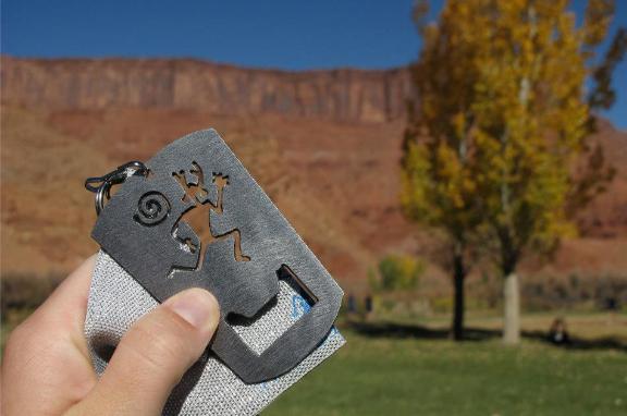
medal / bottle opener

Tuesday, October 16, 2012

ATVs to the Muddy River

Okay.  Most of the time, I do my due diligence as a tiny-car-driving, NPR-donating, vegetarian tree hugger.  But every so often, I get a touch of the redneck and start drooling over big tires, lift kits, and cowboy boots.  Today was definitely one of those days -- Megan, Jordan, and I borrowed two ATVs and a dirt bike and busted out from Goblin Valley towards the Muddy River.  Yeehaw!

in front of the San Rafael Reef
slippery Bentonite mud
The ride from Goblin Valley to the Muddy River is really easy as far as ATV routes go.  It's 28-miles round trip, and you can definitely drive it in a full-sized 4WD vehicle.  (A 2WD with high clearance might be able to make it, but you'd be clenching your cheeks over a couple parts!)  But what it lacks in technical challenge, it makes up for with great views.  You skirt the San Rafael Reef, ride down Wild Horse Wash, then coast through some gorgeous Bentonite Hills with Factory Butte looming in the background.  We had plans to cross the Muddy River, but the lowlands were a huge mud pit and we didn't want to get stuck.  On a good day, you can ford the river and make it all the way down to Swing Arm City, which turns the redneck factor up to 11!

Reneck extravaganza!
Factory Butte

Goblin's Lair Rappel

Embarrassing fact about me:  I almost never stay in Goblin Valley on my days off.  Of course it's a really cool park to work at and there are loads of places I haven't explored.  But for some reason, when my weekend rolls around I want to drive far, far away.  Maybe it's just hard for me to relax when I'm hiking around the park -- it's impossible for me to flip off the 'work' switch.  I start picking up litter, telling people not to carve their names into rocks, building cairns, etc. and suddenly I'm no longer having a relaxing weekend.  It feels like work.

Welcome to my office -- please take a seat!

But it's different when people are out visiting.  Newbies are seeing everything with a fresh perspective, and their enthusiasm is contagious.  It's nice to experience things again with a fresh set of eyes.  So for my sister Megan's last weekend out, we headed into Goblin Valley for a rappelling expedition into the Goblin's Lair.

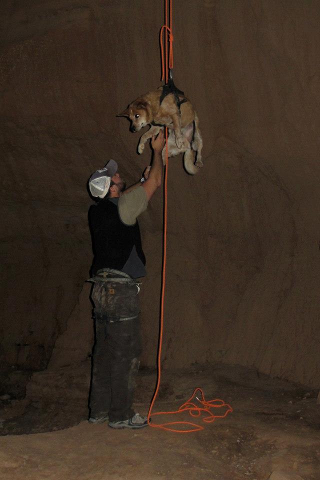
78-foot free rappel! (See Megan?)

Goblin Valley has a handful of spooky/neat caves.  They're not really caves in the classic, limestone cavern sense, but they're snazzy little alcoves made of a Entrada Sandstone.  One of them is tall enough that you can do a 78-foot free rappel into it.  It looks like a huge gothic cathedral with soaring sandstone walls and weird goblin-y texture.  We recruited our rappelling guru Nathan, who hooked us up with harnesses and rope, and started our hike towards the back of the park.

hiking in

Not to mix business with pleasure, but Goblin Valley just set up a backcounty rappelling permit system this year, so make sure you stop by the Visitor Center to fill one out before you do any technical rappelling in the park.  They're free and unlimited -- we're just trying to gage use numbers and watch the resource impact.

Anyway, the top of the rappel route isn't marked, and it takes a little scrambling to find it.  A GPS and map definitely come in handy.  Climb-Utah.com has a great, detailed map and description of the route.  Once you get to the top, you'll see some webbing above a hole.  You put on your harness, hook in, scoot up to the edge, and eeeeease back into an alternate universe!  Getting over the lip of a rappel always makes me nervous, but once you're hanging, there's nothing to it.  Supercool.

going down ...
weeeeeee!
Luke's turn

Once everyone is down, you hike out to the back of the cave.  From there, you head north, hook up with the Carmel Canyon trail, and hit the parking lot.  Nice!

heading out of the Lair 
the hike back

Wednesday, October 10, 2012

Hidden Valley

For the next adventure with my sister, we took Megan on a 4-mile round trip day hike up to Hidden Valley.  This hike is close to Moab, and you get some great views of town and the Behind the Rocks area + some incredible rock art.


Anasazi rock art
switchbacks on the 700 ft. climb

To get to the trailhead, drive 3 miles south from Moab on U.S. 191 and turn right onto Angel Rock Road. After two blocks, turn right onto Rimrock Road and drive to parking area.

The trail takes you up some steep switchbacks to the top of the Moab Rim.  The trail is in great shape -- it's well marked and easy to follow.  After climbing around 700 feet, the hike levels out to Hidden Valley, which is pretty and grassy.  It's cool to look over the rim and see the town below.  Every time I've been there, it's been cold and shady, so if it's not summer, bring a jacket!

After hiking through the valley, the trail swings to the left and goes over a low pass.  You get some fantastic views of the Behind the Rocks area.  Best of all, the big butte on the right is coated with rock art.  Hop off the trail and skirt the bottom of the cliff to see loads of thousand-year-old petroglyph panels.  Both Anasazi and Fremont cultures overlapped here as they used this route to get into Spanish Valley.  Nice!  If you're feeling feisty and have a shuttle car, you can keep hiking to the Colorado River via the Moab Rim Trail.


looking out over Behind the Rocks area


Map credit:  http://www.blm.gov/ut/st/en/fo/moab/recreation/hiking_trails/hidden_valley_trail.html


About Us